
Every satellite navigation signal that reaches the Earth’s surface arrives weaker than the background noise of the universe. A GPS satellite transmits from 20,000 kilometres up on roughly the power of a car headlight. By the time that signal reaches a receiver it is so faint that a jammer the size of a shoebox, sitting on a truck, can drown it out across an entire province. This is not a flaw anyone can engineer away. It is physics.
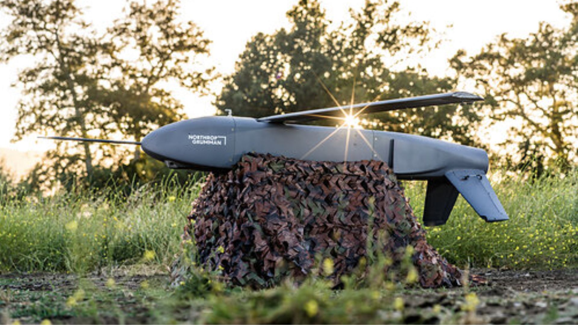
Which is why Northrop Grumman spent part of this summer flying a one-way attack drone over Fort Hunter Liggett in California with the satellites effectively switched off, navigating instead by reading the magnetic field of the rock underneath it.
Quick Facts
Aircraft: Northrop Grumman Lumberjack, a Group 3 attritable one-way attack UAS
Announced: 9 September 2026, Fort Hunter Liggett, California. Northrop has not published the test date
Navigation: SandboxAQ AQNav magnetic anomaly navigation, using quantum magnetometers, paired with a visual navigation system
Airframe: ESAero Inc., a wholly owned subsidiary of AV Inc. Palantir also named as a partner
Size: About 71 in long, 14 in wide, 10 in high. Jet-powered
Range: Roughly 200 miles, with a loiter time reported at a couple of hours
Warload: 250 lb class, and it can dispense 6 lb Hatchet precision submunitions
Integration: AQNav is software-only. Engineers loaded it onto the drone’s existing computer in under an hour
What Lumberjack is
Lumberjack is not a reconnaissance drone that happens to carry a warhead. It is a munition with wings, built to be lost. Northrop calls it attritable, which is the polite industry word for a weapon cheap enough that nobody weeps when it does not come home. Reported unit cost sits somewhere between $75,000 and $100,000.
It went from a clean sheet to first flight in under fourteen months, made its public debut at Modern Day Marine in May 2025, and has since appeared at the US Army’s Operation Lethal Eagle. It can be launched from the ground or from another aircraft, and it carries a 250 lb-class payload that can be dispensed as a cluster of small Hatchet guided submunitions rather than one large bang.
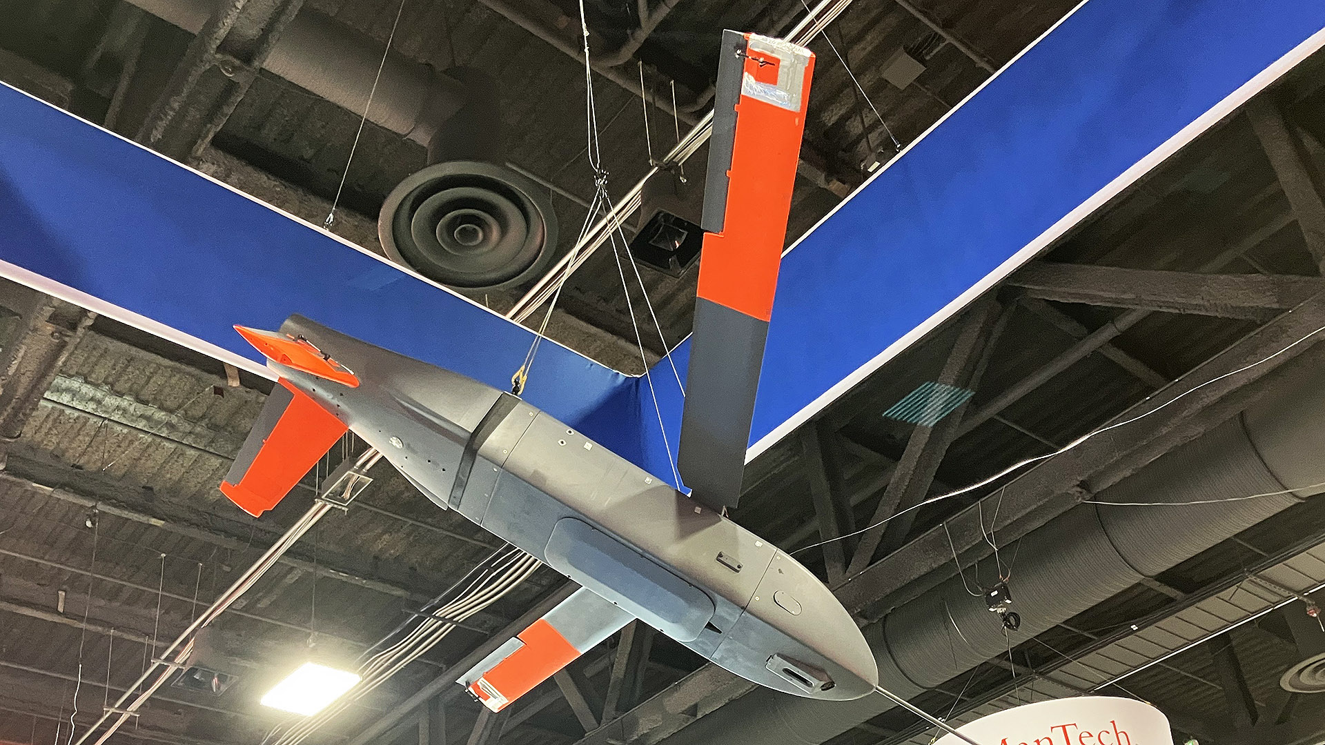
Roughly seventy-one inches long and jet-powered, it is built to fly about two hundred miles and loiter for a couple of hours before it finds something worth hitting. Which is exactly the kind of mission profile that falls apart the moment somebody switches on a jammer.
The problem with satellites
The numbers on GPS interference have gone from worrying to routine. IATA recorded a 193 percent rise in GPS spoofing incidents between 2023 and 2025. Eurocontrol logged more than 2,500 jamming events across Europe in 2024 alone, with as much as 38 percent of European en-route traffic passing through regions of regular radio-frequency interference. In September 2025 an aircraft carrying the president of the European Commission circled over Bulgaria for the better part of an hour after losing its satellite fix.
Military planners stopped treating GPS denial as an edge case some years ago. The question became what you use instead.
The classic answer is an inertial navigation system: accelerometers and gyroscopes that dead-reckon from a known starting point. The problem with inertial navigation is that its error is unbounded. It does not settle at some acceptable figure; it grows, steadily, for as long as the flight lasts. Terrain-contour matching helps if there is terrain to match, which rules out open water and flat plains. Vision-based navigation needs daylight, decent weather and features worth recognising.
Reading the rock
Magnetic anomaly navigation takes a different route. The Earth’s crust is not magnetically uniform. Iron-bearing rock, geological structure and ancient lava flows give every patch of ground its own magnetic signature, and those signatures are stable and already mapped. Fly across them with a sensitive enough magnetometer and you can match what you are reading against the map and work out where you are.
The catch has always been sensitivity. The crustal anomalies are tiny compared with the electromagnetic racket generated by the aircraft carrying the sensor. This is where the quantum part comes in, and it is worth being precise about it, because the phrase gets thrown around loosely. There is no quantum computer aboard Lumberjack. What there is, is a quantum magnetometer — a sensor that uses quantum effects to measure magnetic fields far more finely than a conventional instrument — feeding a software package from SandboxAQ called AQNav, which uses AI models to strip out the aircraft’s own magnetic noise and match the remainder against the map.
One honest caveat, and it comes from SandboxAQ’s own release rather than from any sceptic: the magnetic system was paired with a visual navigation system for this flight. This was not a drone flying on quantum magnetometry alone. The company describes it as the first reported instance of magnetic navigation being combined with visual navigation on an attritable one-way attack platform, and the hedge in the phrase “first reported” is theirs.
The number that actually matters
Northrop released no accuracy figure, no drift figure and no test date for the Lumberjack flight. The claims are qualitative: it resisted jamming, it operated reliably. That is contractor language, and there is no independent test authority or government voice anywhere in this announcement.
For hard numbers you have to look at an earlier and entirely separate campaign, flown with Airbus’s Acubed division on a standard Beechcraft Baron 58 with no electromagnetic shielding: 101 sorties, more than 44,000 km, over 150 flight hours between 200 US airports. Best observed accuracy was better than 74 metres. It held RNP 2.0 navigation performance for 100 percent of flight time and RNP 1.0 for 95 percent.
And the line that explains why anyone bothers: on flights lasting more than two hours, the magnetic system outperformed an unaided inertial system 100 percent of the time. Seventy-four metres is not impressive next to GPS. But seventy-four metres that stays seventy-four metres beats an inertial solution that is excellent for ten minutes and useless after ninety.
That hour is arguably the more significant claim. AQNav is sold as hardware-agnostic software. If a navigation system that survives jamming can be pushed onto an existing airframe’s existing computer in an afternoon, the economics of retrofitting a fleet change completely.
What it means for cheap weapons
Magnetic navigation is passive. It emits nothing, so it cannot be detected or jammed the way a radar altimeter or a datalink can. It works at night, through cloud, and — unlike terrain matching — over featureless ocean, which is the capability Northrop’s release specifically calls out.
The strategic point is about cost. Precision used to be expensive because precision meant either satellites or an exquisite inertial platform. If a magnetometer and a software licence can give a $75,000 drone a bounded position solution in a jammed environment, then the cheap end of the weapons market gets a capability that used to belong to the expensive end. Both sides of any future conflict will work that out at roughly the same speed.
SandboxAQ has been flying this technology since 2023 with partners including Airbus and Boeing, and has spent more than three years on US Air Force work aboard C-17 and C-130J transports. It sat in NATO’s DIANA cohort in 2025 and is currently in the Defense Innovation Unit’s Transition of Quantum Sensing programme. The Lumberjack flight is not the beginning of this story. It is the point where it arrived on a weapon.
SandboxAQ’s own explainer on how AQNav turns the Earth’s magnetic field into a position fix.
Northrop has also published footage of the Hatchet submunition that Lumberjack is built to dispense, which gives a better sense of what arrives at the far end of those two hundred miles.
Frequently Asked Questions
What is the Northrop Grumman Lumberjack?
Did the Lumberjack really navigate without GPS?
What does quantum navigation actually mean here?
How accurate is magnetic navigation compared with GPS?
Can magnetic navigation be jammed?
How bad is GPS jamming for aviation today?
Has this been independently verified?
Sources: Northrop Grumman newsroom; SandboxAQ; Seapower; Defence Blog; aeroTELEGRAPH; TWZ; The Defense Post; IATA 2025 safety report; Eurocontrol.


0 Comments