
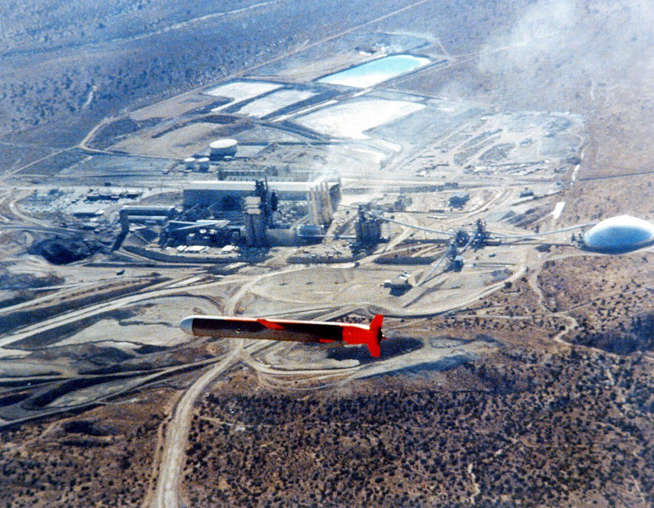
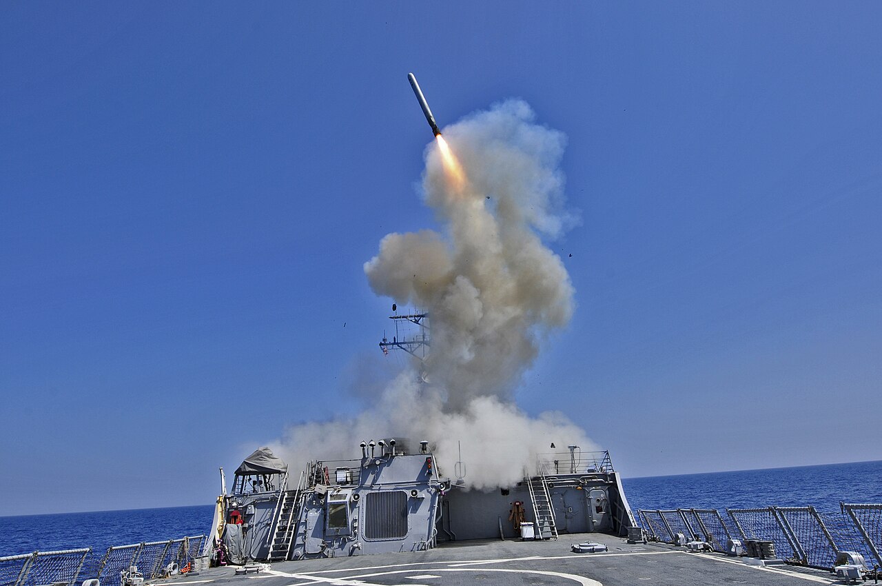
A Tomahawk leaves a destroyer’s deck, climbs, settles down to a few hundred feet and flies for up to 1,600 kilometres (870 miles) at 880 km/h (550 mph). At the end of that, it is expected to arrive at a specific building. Not a city. A building.
The obvious question is how it knows where it is. The obvious answer — GPS — is wrong, or at least late. The Tomahawk was hitting buildings for years before a GPS receiver was ever fitted to one.
What it used instead is a stack of navigation systems, each covering the weaknesses of the others. Three of the four are entirely passive: they transmit nothing, so there is nothing for a defender to jam. In 2026, with satellite navigation interference now a routine feature of European and Middle Eastern airspace, that stack has stopped being a historical curiosity.
Kurzinfo
Guidance suite: TAINS (TERCOM-Assisted Inertial Navigation System) for the cruise, DSMAC for the terminal phase
TERCOM hardware: McDonnell Douglas AN/DPW-23, using a radar altimeter and stored elevation maps
DSMAC hardware: AN/DXQ-1, an intensified CCD camera matching the ground against reference scenes
TAINS accuracy: about 80 m (260 ft) CEP — sufficient for a nuclear warhead, not for a conventional one
DSMAC accuracy: about 10 m (30 ft) CEP
GPS added: Tomahawk Block III. First Block III launch January 1991, initial operational capability May 1993
Ancestor: Goodyear ATRAN, mated to the MGM-1 Matador from August 1952, production contract June 1954
Combat debut: Operation Desert Storm, 1991 — 261 TLAM-C and 27 TLAM-D fired, overall hit rate reported at 85 per cent
An Inertial System Is Always Wrong, and Gets Worse
An inertial navigation system measures nothing outside itself. Gyroscopes and accelerometers record how the vehicle has rotated and accelerated, the computer integrates that twice, and out comes a position. It is elegant, completely passive and impossible to jam, because nothing is coming in to interfere with.
It is also always drifting. Small sensor errors integrate into larger velocity errors, and those integrate into larger position errors still. The error does not oscillate around the truth. It grows, steadily, for the whole flight.
So the missile needs fixes — something that periodically tells it, from outside, where it actually is. The Tomahawk carries three different ways of getting one.
TERCOM Reads the Ground Like a Barcode
Terrain Contour Matching is the first of those fixes, and the cleverest.
A radar altimeter in the missile’s belly measures the distance down to the ground. Note what that is nicht: it is not altitude above sea level. It is the gap between the missile and whatever happens to be underneath it, and that gap changes as the ground rises and falls.
TERCOM does not care about the absolute number. It cares about the pattern of changes.
The altimeter feeds a small buffer, which gates the readings over an interval and averages them into a single value. String those values together and you have a profile: down, down, sharply up, level, down. The missile’s memory holds elevation maps of the route, cut into a grid of squares and built from radar mapping satellite data. The computer slides the measured profile across the stored map until the sequence of changes lines up. A match yields both a position and a direction.
Because a fresh fix arrives every time the missile crosses a mapped patch, TERCOM accuracy does not decay with the length of the flight. The inertial platform drifts; TERCOM resets it. That combination is TAINS, and it is what the Tomahawk actually flies on.
Two consequences follow, and both mattered. A position you can trust is what buys the low altitude — the missile can hug valleys and use terrain to stay out of the line of sight of air defence radar. But TERCOM only works over ground that has relief. Over water there is nothing to match, because the sea is flat and it moves. Over genuinely flat land there is nothing to match either: one featureless plain produces a profile indistinguishable from the next.
The 1950s Ancestor Ran on 35 mm Film
The idea is older than the Tomahawk by a quarter of a century.
Goodyear Aircraft’s ATRAN — Automatic Terrain Recognition And Navigation — is the earliest known system of this kind. Air Materiel Command began mating it to the MGM-1 Matador in August 1952, and a production contract followed in June 1954. It went on to fly with the MGM-13 Mace.
ATRAN stored no elevation grid, because there was nothing to store one on. Instead a pathfinder aircraft flew the intended route first, its radar set at a fixed angle, scanning the land ahead. The returns produced an amplitude-modulated signal, which was fed to a light source and exposed onto 35 mm film. Develop the film, copy it, load a print into each missile.
In flight, the missile’s own radar produced the same kind of signal. A second channel scanned the film against a photocell and produced a comparable one. Where the two patterns of brightness change disagreed, the autopilot corrected. It was, functionally, a missile navigating by comparing the world against a photograph of what it should be seeing. Hard to jam, and unlike a radio-guided system it was not limited by line of sight. The constraint was maps: somebody had to fly the route first.
Eighty Metres Was Good Enough Only Because of the Warhead
TAINS, built around the McDonnell Douglas AN/DPW-23, delivers roughly 80 m (260 ft) CEP.
Circular error probable is the radius of a circle around the aim point that half the shots land inside. Eighty metres means half the missiles come down within 80 m of the target, and half land further out than that.
For the BGM-109A TLAM-N and its variable-yield W-80-0 warhead, rated at 5 to 200 kilotons, that was entirely adequate. The same held for the ground-launched BGM-109G Gryphon with its W-84, deployed in Europe from 1983 and withdrawn under the INF Treaty between 1988 and May 1991.
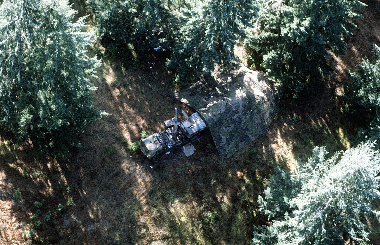
For a conventional warhead it is not remotely adequate. A 450 kg (1,000 lb) blast-fragmentation warhead that arrives 80 m from a bunker has missed. The moment the Navy wanted to put a conventionally armed Tomahawk against a specific building, TERCOM stopped being enough.
DSMAC Opens the Missile’s Eyes
The Digital Scene Matching Area Correlator — DSMAC, designated AN/DXQ-1 — closed the gap, and it does so by looking.
An intensified charge-coupled device camera photographs the ground beneath the missile. At night a high-intensity strobe supplies the light. Gain and gating adjust automatically to hold a usable signal level whether it is noon or midnight, and exposures are kept short so the missile’s own motion does not smear the scene.
Each frame is then, in a sense, thrown away. The system spatially averages it, subsamples it, filters out the local average brightness and reduces it to a single-bit black-and-white image in which each pixel records nothing more than the sign of the filter output. The reference scene — built beforehand from reconnaissance imagery by a mainframe and warped into a straight-down view — has been through exactly the same reduction.
Reducing both to binary is the trick. It turns the comparison into a count of matching pixels, fast enough to run inside a missile, and it strips out precisely the things that differ between the reconnaissance pass and the strike: overall brightness, seasonal colour, time of day.
One frame is not enough, because the highest correlation peak can sit in the wrong place. Block II handled that by voting. It takes three consecutive frames, compares their relative peak positions against the positions predicted from the missile’s own known velocity, altitude and attitude, and accepts the fix only if at least two of the three agree. Block IIA does something more elegant: it shifts each correlation surface to compensate for the missile’s motion and adds them together, so the true peak reinforces itself while the false ones, being random, do not.
The result is roughly 10 m (30 ft) CEP. The APL engineers who helped develop it were blunt about why it exists: DSMAC, they wrote, “produces the most precise positions; its use is required to attack most targets effectively with a conventional warhead and to minimize collateral damage.”
Desert Storm Ran the Experiment on the Worst Possible Ground
The Tomahawk’s combat debut came in January 1991, opening the air campaign alongside the F-117 Nighthawk. Across the war, 261 TLAM-C and 27 TLAM-D missiles were fired at Iraqi targets, with an overall hit rate reported at 85 per cent.
The conditions were close to the worst case for the guidance package, because Iraq and Kuwait are flat. The US General Accounting Office’s 1995 review of cruise missile performance put it plainly:
That was not an abstract complaint. Routes had to be bent to cross whatever relief existed, which funnelled the missiles into a limited set of ingress corridors. A Center for Naval Analyses study cited in the same report found the success rate for Tomahawks fired in the first two days of the air war was much higher than for those fired later — consistent with Iraqi gunners learning where to look.
The planning burden was the other cost. TERCOM data came from the Defense Mapping Agency; DSMAC scenes came from intelligence imagery, and because ground contrast changes between night and day and across the seasons, that imagery had to match the conditions of the strike itself. With the data already in hand, planning a Block II mission took 24 to 80 hours. When the imagery was not in hand it took longer, and Navy officials confirmed that this delay occurred during Desert Storm.
GPS Arrives and Removes the Constraint
The answer was Block III. Development began in the late 1980s at McDonnell Douglas, the first Block III launch came in January 1991, and initial operational capability followed in May 1993.
Block III added a GPS receiver to assist TAINS and upgraded DSMAC to the 2A standard, which draws on a wider range of imagery and more scenes for the final fix. It also fitted the lighter WDU-36/B warhead, which freed volume for fuel and pushed TLAM-C range from roughly 1,250 km to about 1,600 km (870 miles).
GPS changed the planning problem more than it changed the accuracy. With satellite fixes available, route planning no longer had to be organised around terrain relief and mission planning time fell sharply. The missile could be sent across flat ground, because it no longer needed the ground to tell it anything.
Block IV, the Tactical Tomahawk, went further still: retargeting in flight over a UHF satellite link to any of fifteen pre-programmed alternates or to arbitrary coordinates, loiter time over the target area, and an onboard television camera for battle damage assessment. Block V, delivered from 2021, upgraded navigation and communications again.
The Weak Link Is Now the Newest Layer
There is an irony in that sequence.
A GPS signal arriving at a receiver on the ground is extraordinarily faint. It has crossed some 20,000 km from a satellite transmitting on modest power, and it reaches the surface below the level of the background noise; recovering it at all depends on knowing exactly what to look for. Overwhelming it therefore does not take much. That is not an engineering defect anyone can fix. It is a consequence of the geometry.
And interference is no longer exotic. Switzerland suspended an instrument landing system at Bern this year over spoofing concerns. Aircraft over the Baltic and the eastern Mediterranean lose satellite navigation routinely.
Which makes the old, awkward, map-hungry systems interesting again. TERCOM and DSMAC transmit nothing at all. There is no signal to jam, because they read the world rather than asking it a question. Their weaknesses are real — they need terrain, they need prepared imagery, they need the scene to look roughly as it did when a satellite last photographed it — but not one of those weaknesses can be induced by an adversary with a transmitter.
Which is why current work on navigation without satellites looks less like invention than like a return to first principles with better sensors. Northrop Grumman spent part of this summer flying an attritable one-way attack drone that navigated by the magnetic signature of the rock beneath it — conceptually the same move TERCOM made in the 1970s. Find something about the ground that is fixed, measure it, match it against a map.
The Tomahawk worked out decades ago that a missile should not depend on anything it has to be told. Everyone else is catching up.
Sources: Andreas Parsch, Directory of U.S. Military Rockets and Missiles (AGM/BGM/RGM/UGM-109 Tomahawk); Geoffrey B. Irani and James P. Christ, “Image Processing for Tomahawk Scene Matching”, Johns Hopkins APL Technical Digest 15(3), 1994; US General Accounting Office, NSIAD-95-116, April 1995.

0 Comments