
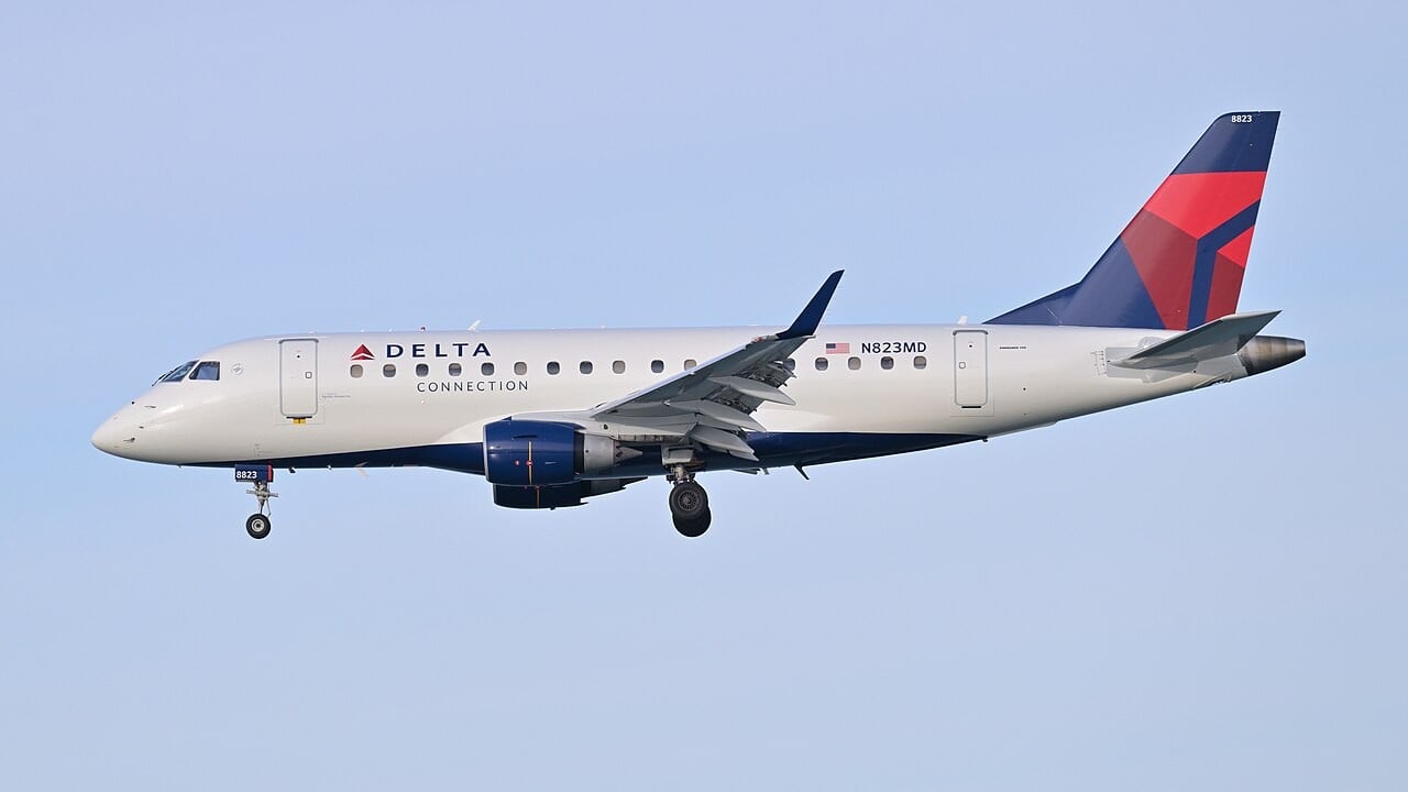
An Embraer 170 flew from Puget Sound to southern Alaska and back, four hours and twenty-three minutes, with GPS switched off the whole way. It navigated by reading the magnetic field of the rocks underneath it.
This is being reported in several places as the US Air Force testing quantum inertial sensors. It was not the Air Force, and it was not inertial. Both details matter, because the thing that actually flew is more interesting than the thing being described.
Quick Facts — The 4 September 2026 test flight
WHO: Defense Innovation Unit with Honeywell Aerospace — not AFRL, not the USAF
Flugzeug: Embraer 170, a civil regional jet
Route: Puget Sound, Seattle, to southern Alaska and back, over the Pacific
Dauer: 4 hours 23 minutes, GPS-denied throughout
Technologie: MagNav — magnetic anomaly navigation, not quantum inertial navigation
Claimed result: 89% better position accuracy than traditional backup navigation methods
Programm: Transition of Quantum Sensing, launched spring 2024; 72 companies responded
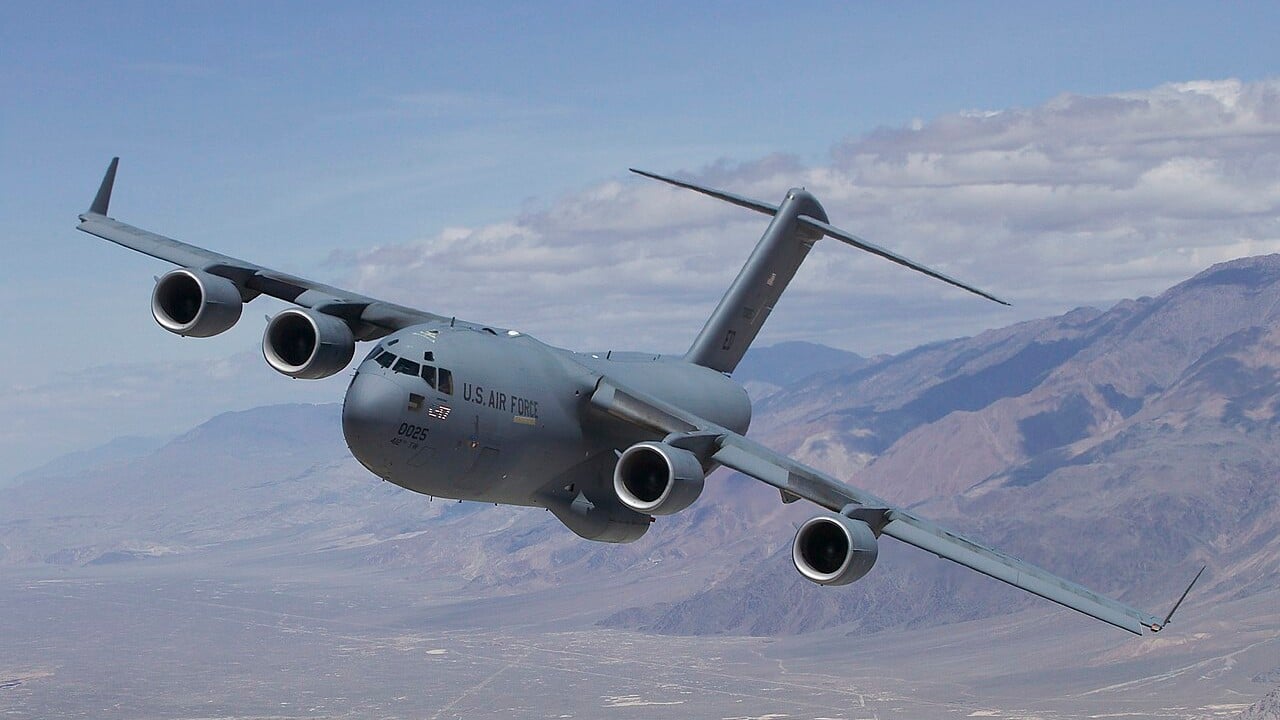
Nächste: A demonstration on a USAF C-17 Globemaster III later in 2026
Two Different Things That Keep Getting Confused
There are two ways to navigate without satellites using quantum sensors, and they are not the same.
Quantum inertial navigation uses atom interferometry. Lasers cool atoms to near absolute zero and split their matter-wave along two paths; acceleration and rotation shift the resulting interference pattern. Because the measurement is referenced to atomic mass and laser wavelength — physical constants — there is no mechanical bias or scale factor to age. A conventional ring-laser-gyro inertial system drifts because those parameters wander with temperature, vibration and time, and dead reckoning integrates that error twice, so position error grows roughly with the square of elapsed time. A quantum inertial unit does not abolish drift. It shrinks the bias being integrated.
Magnetic anomaly navigation is something else entirely. Iron-bearing crustal rock produces a fixed, unique pattern of tiny variations in the Earth’s magnetic field. A quantum magnetometer measures the local field strength to picotesla precision, and software matches that live trace against a pre-existing magnetic map. The output is an absolute position fix, like GPS, except it reads the ground instead of satellites.
The crucial difference is that MagNav error is bounded. It does not grow with distance, because it is map-matching rather than dead reckoning. That is exactly why it works over open ocean, where terrain-referenced and visual navigation have nothing to work with — and it is why the route ran up the Pacific rather than over land.
In practice the two are complementary: the magnetometer bounds the inertial drift. Honeywell runs both as separate programmes — CRUISE for the quantum inertial unit, QUEST for MagNav.
About That 89 Per Cent
The headline figure deserves reading carefully. The 89 per cent improvement is measured against what DIU calls traditional backup navigation methods — radar mapping and visual cues such as rivers, highways and cities.
That is not a comparison against GPS. It is not a comparison against a strategic-grade inertial system either. It is a comparison against the weakest available fallback. No absolute accuracy in metres has been published, no drift rate, and no detail on which magnetic map was used.
For contrast, Q-CTRL published far more rigorous numbers in April 2025: positioning uncertainty around 0.03 per cent of distance travelled, best trials near 0.01 per cent, up to fifty times lower uncertainty than a strategic-grade inertial system over a 500-kilometre flight, and 99.97 per cent uptime — using magnetic maps taken from public-domain databases rather than a bespoke survey. That work went to a preprint others can check.
This Is Not the First
The honest framing is an incremental programme milestone, not a breakthrough.
In May 2024, Infleqtion flew the first publicly acknowledged quantum navigation trials anywhere, with BAE Systems and QinetiQ, from MoD Boscombe Down in Wiltshire, aboard QinetiQ’s RJ100 testbed. Britain’s science minister flew on the final sortie on 9 May.
Boeing went further. In flights announced in March 2025, a six-axis quantum inertial measurement unit built with AOSense was integrated into a full inertial navigation system and flown on a Beechcraft 1900D out of St. Louis — four hours without GPS, eighteen months ago. The same flights carried a SandboxAQ magnetometer and a daytime star tracker. Boeing put the benefit at reducing end-of-flight navigation error from tens of kilometres to as little as tens of metres.
And in August 2026, Q-CTRL demonstrated GPS-free quantum gravimetric navigation at sea aboard an Australian Navy vessel, running 144 hours continuously without human intervention on 180 watts in a single server rack.
So Boeing had already flown four GPS-free hours with quantum sensors. What DIU and Honeywell added is a longer flight, over featureless ocean, with the output streamed live to pilots on ordinary tablets — the point being that no cockpit retrofit is required.
Q-CTRL’s explanation of magnetic navigation, which is the clearest published account of how map-matching actually works.
Why Anyone Is Bothering
Because satellite navigation is under sustained attack, and the numbers are not subtle.
IATA’s 2025 safety report recorded GPS jamming up 67 per cent and spoofing up 193 per cent against 2023, concentrated in the Eastern Mediterranean, the Middle East, the Baltic and the Black Sea. The Swedish Transport Agency logged 733 jamming incidents over the Baltic between January and August 2025, against 55 in the whole of 2023. Vilnius recorded more than 800 interference reports in the last quarter of 2024, against 124 a year earlier.
It has already changed schedules. Finnair suspended flights to Tartu in 2024 after two aircraft could not complete approaches. A Ryanair service to Vilnius diverted to Warsaw in January 2025. EASA issued the fourth revision of its safety bulletin on satellite navigation outages on 3 July 2026, warning that incidents are becoming both more severe and more sophisticated.
What to Watch
The next step is a C-17 Globemaster III later this year, which is where it stops being a civil testbed and starts being an airlift capability.
Two things are worth keeping in proportion. The published performance figures are still weak by the standards of what competitors have already documented, and the programme moved from problem statement to flying prototype in about two years — which is genuinely fast for defence procurement and is arguably the real achievement here.
One myth to retire while we are at it: there is no credible published evidence of a Chinese quantum navigation flight trial. China has flight-tested a drone-mounted atomic magnetometer, but that was magnetic anomaly detection for hunting submarines, which is a different job.
Häufig gestellte Fragen
Did the US Air Force test quantum navigation sensors?
What is magnetic anomaly navigation?
How is that different from quantum inertial navigation?
How good is the accuracy?
Has anyone flown GPS-free with quantum sensors before?
Why does GPS-denied navigation matter now?
Sources: Defense Innovation Unit, 4 September 2026; Honeywell Aerospace; FlightGlobal; Airforce Technology; Boeing; Q-CTRL and its April 2025 preprint; QinetiQ and Infleqtion; IATA 2025 Annual Safety Report; Swedish Transport Agency; EASA.

0 Kommentare