
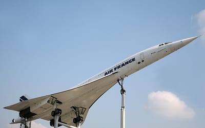
The Strait of Hormuz — twenty-one miles wide at its narrowest pinch point, carrying roughly a fifth of the world’s seaborne oil through its cold green choke — has always been a place where geography bends geopolitics. For decades, the debate was about what would happen if Iran tried to close it. Now a different question is being asked: how far does Iran’s Hormuz begin?
On Tuesday, Rear Admiral Mohammad Akbarzadeh of the Islamic Revolutionary Guard Corps Navy made an announcement that reframes the entire strategic picture. Speaking on FARS News Agency, Akbarzadeh declared that the IRGC’s operational definition of the Strait of Hormuz now extends from the port of Jask in the east to Siri Island in the west — a “complete crescent” encompassing waters roughly 200 to 300 nautical miles across. That is, in blunt terms, a tenfold expansion of the zone Iran considers to be Hormuz.
The announcement landed in a sea already thick with tension. Twenty US Navy warships are currently maintaining a blockade posture in and around the Strait. Most commercial shipping has halted since the war began. Iran did not specify what actions it intends to take within the newly defined zone — but then, it didn’t need to. The declaration itself is the message.
Quick Facts
- Old IRGC Definition: 20–30 nautical miles
- New IRGC Definition: 200–300 nautical miles — “complete crescent” from Jask to Siri Island
- Announced by: Rear Admiral Mohammad Akbarzadeh, IRGC Navy, via FARS News Agency
- US Presence: 20 warships enforcing blockade in the Strait and Persian Gulf
- Shipping Status: Strait closed to most commercial traffic since the war began
- Iran’s Stated Actions: None specified — expansion of definition only
A Geography Lesson No One Wanted
To understand what Iran has done, you need to look at a map slowly. Jask sits on the Makran coast, Iran’s austere southeastern shore on the Gulf of Oman — well outside the Strait proper, past the point where the Gulf of Oman opens into the wider Indian Ocean. Siri Island lies far to the west in the Persian Gulf, near Abu Musa, the island Iran has disputed with the UAE since 1971. The arc between them — the “complete crescent” Akbarzadeh described — encompasses not just the chokepoint itself but the entire approach corridor, the departure corridor, and the waters where US carrier strike groups typically operate when projecting force into the Gulf.
In one press statement, Iran has repositioned the legal and operational geography of the crisis. If Tehran claims the right to act within this expanded zone — to stop, inspect, or engage vessels — it is no longer merely defending the Strait. It is asserting a maritime buffer that overlaps with international waters used by every major naval power with Gulf interests: the United States, the United Kingdom, France, India. The escalatory implications cascade quickly.
The timing is deliberate. With twenty American warships already in the area enforcing a blockade, any ambiguity about where Iran considers its maritime sphere of influence to end creates friction points across hundreds of miles of ocean. An Iranian fast boat intercepting a tanker sixty miles south of the Strait entrance is now, in the IRGC’s telling, operating within Hormuz — not outside it. That definitional shift matters enormously in any post-incident diplomatic argument.

The Silence That Speaks Loudest
Iran’s refusal to specify what actions it will take within the expanded zone is not an oversight — it is a feature. Strategic ambiguity is one of the IRGC’s most consistently used tools. By declaring a zone without defining its enforcement mechanisms, Tehran has forced every vessel transiting those waters to make its own risk calculation. Will the IRGC board? Fire warning shots? Seize cargo? The uncertainty itself imposes costs on shipping insurers, charterers, and naval planners alike.
This is a pattern Rear Admiral Akbarzadeh and his predecessors have used before, in different forms. In 2019, Iran announced expanded maritime patrol zones that similarly blurred the line between territorial waters and international sea lanes. The difference now is that a shooting war has already begun, commercial shipping has already stopped, and twenty US warships are already positioned. The margin for miscalculation is substantially smaller.
The United States Fifth Fleet declined immediate comment at time of publication. Unofficially, naval analysts noted that US rules of engagement for vessels operating in the area were already calibrated for a hostile environment — the expanded Iranian definition changes Iran’s legal posture, not the tactical situation on the water.

What Comes Next
Three scenarios are now live simultaneously. In the first, the declaration remains rhetorical — a signalling move designed to remind Washington that escalation costs are not one-directional, without triggering an immediate confrontation. This is Iran’s historical default: announce, observe reactions, act selectively. The expanded zone exists on FARS News, not yet on water.
In the second scenario, Iran begins selective enforcement — boarding or turning back specific vessels it considers hostile, under the cover of the new zone definition. This has happened before with tankers; the question is whether the political calculus of doing so within a declared zone of expanded Iranian authority changes the international response.
In the third scenario, an incident occurs without deliberate Iranian initiation — a misidentification, a communications breakdown, a nervous crew. The expanded zone declaration will then form part of Iran’s post-incident legal argument, regardless of what actually happened. That is perhaps the most dangerous use of the announcement: not as a tool of deliberate escalation, but as pre-positioned justification for whatever follows.
For now, the twenty American warships steam slow circles in waters Iran has just decided to call its own. The map has been redrawn. What happens next depends on which actor blinks, and in which direction.
Sources: FARS News Agency, US Naval Institute, Reuters, al-Monitor, Middle East Eye
0 Comments