When governments on both sides of a conflict control the narrative — denying strikes, minimising damage, and curating imagery — how does the world know what actually happened? Bellingcat’s answer is a tool that bypasses official channels entirely: the Iran Conflict Damage Proxy Map, an open-source platform that uses European Space Agency Sentinel satellite imagery to automatically detect and map destruction across Iran and the wider Gulf region.
The tool, released in an updated version in April 2026, allows anyone with an internet connection to assess bomb damage independently — no government permission required, no press access needed, no reliance on official statements that may or may not reflect reality.
Quick Facts
Tool: Iran Conflict Damage Proxy Map
Created by: Bellingcat
Data source: ESA Sentinel satellite imagery (freely available, publicly accessible)
Purpose: Independent damage assessment regardless of government disclosures
How Satellite Change Detection Works
The Sentinel satellites, operated by the European Space Agency as part of the Copernicus programme, carry synthetic aperture radar (SAR) instruments that image the Earth’s surface regardless of cloud cover or darkness. Unlike optical cameras, SAR bounces radar pulses off the ground and measures the return signal — creating a detailed map of surface texture and structure.
Sentinel-2 satellite imagery — Bellingcat’s new damage proxy map uses this freely available European Space Agency data to identify destruction across the Gulf region. Wikimedia Commons / ESA
When a building, runway, or military installation is destroyed by an airstrike, its radar signature changes dramatically. A flat, intact roof returns a clean, strong signal. A pile of rubble returns a chaotic, scattered signal. By comparing SAR images from before and after a strike, analysts can identify areas where the radar return has changed significantly — a technique called coherence change detection.
Bellingcat’s tool automates this process across large geographic areas, flagging locations where Sentinel data indicates probable structural damage. The results are displayed on an interactive map that users can zoom into, compare with pre-conflict imagery, and cross-reference with other open-source intelligence.
Why It Matters Now
The Iran conflict has produced an unusually opaque information environment. Iran restricts media access to strike sites. Gulf states, as Bellingcat’s separate investigation revealed, have downplayed successful strikes on their own territory. The United States provides battle damage assessments through official channels, but these are filtered through the Pentagon’s public affairs apparatus and may not reflect the full picture.
The damage proxy map fills the gap. When the UAE says all incoming drones were intercepted, analysts can check the satellite data for themselves. When Iran claims a military base sustained no damage, the coherence map shows whether structures changed between satellite passes. When any party asserts that civilian areas were untouched, independent observers can verify the claim — or debunk it.
This is not theoretical capability. During the early weeks of Operation Epic Fury, open-source analysts used commercial satellite imagery to identify damage at Iranian air bases, port facilities, and missile production sites that had not been publicly acknowledged by either side. Bellingcat’s tool makes this kind of analysis accessible to anyone, not just professionals with expensive commercial satellite subscriptions.
The Accountability Revolution
The broader significance extends beyond the current conflict. Every future military campaign will be conducted under the eye of freely available satellite surveillance. Governments can no longer assume that restricting media access or controlling official imagery will be sufficient to shape the narrative. The data exists in orbit, collected by European satellites, processed by open-source tools, and accessible to every journalist, researcher, and citizen on earth.
For militaries accustomed to controlling information about their operations, this is an uncomfortable reality. For civilian populations caught in conflict zones, it is something closer to a lifeline — proof that what happened to their neighbourhoods, hospitals, and infrastructure is recorded somewhere that no government can erase.
Bellingcat has built a tool that does what satellite intelligence agencies have done for decades — but without the classification, the bureaucracy, or the political filters. In the age of open-source intelligence, accountability comes from orbit.
Sources: Bellingcat, European Space Agency Copernicus programme
Open-source investigators have identified Russian-made cluster munitions used in an airstrike in northern Mali, according to a Bellingcat investigation published May 26, 2026. The findings add to mounting evidence that Russian forces operating alongside Mali's...
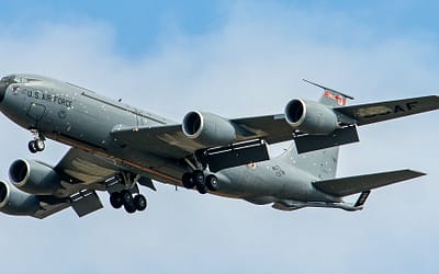
The U.S. Air Force's KC-135 Stratotankers — the 60-year-old aerial refueling workhorses that keep American air power flying — are taking hits in the Iran war. Six aircraft have been damaged since the conflict began — a figure that covers aircraft damaged but not...
When Iranian ballistic missiles slammed into Al Udeid Air Base in the early weeks of the war, they hit the most important building on the base: the Combined Air Operations Center. The CAOC — the nerve center that coordinates every U.S. and coalition aircraft across...


0 Comments